East Tennessee Weather II

I’m in West Knoxville, Hardin Valley area. What are you thinking for this area? When I look at Weatherbug it shows little to no accumulation in Knoxville but up to 3 inches in Oak Ridge and we’re in between. The lows are only around 36-37 in Knoxville so I lean towards nothing happening. What do you see?
I tell you what...this is a tough one. I think the recent NWS post about the event talked about it pretty well.
I think we'll see some heavier snow beneath the upper low, but exactly where that occurs and how much the air column is cooled through dynamic cooling will determine snowfall accumulations. Right now, I'd venture that the most likely place of seeing some heavier snow will be in the mountains; and as for valley locations, mostly east of Knoxville.
 
  • Like
Reactions: hUTch2002
I tell you what...this is a tough one. I think the recent NWS post about the event talked about it pretty well.
I think we'll see some heavier snow beneath the upper low, but exactly where that occurs and how much the air column is cooled through dynamic cooling will determine snowfall accumulations. Right now, I'd venture that the most likely place of seeing some heavier snow will be in the mountains; and as for valley locations, mostly east of Knoxville.


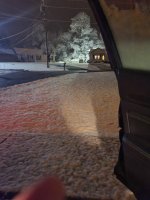
Timing is going to be key too. I think it’ll set up a little like the Christmas system. The Sunday night system is intriguing too. It looks like we will have several shots of snow.
 
Keeping a close eye on this one as my work commute from east Knoxville to oak ridge is at 6am. Could be a slow one tmr. Looks of good info in here. Thanks
 
Timing is going to be key too. I think it’ll set up a little like the Christmas system. The Sunday night system is intriguing too. It looks like we will have several shots of snow.
I just wish this system was as clear cut as the Christmas Eve system. This thing is so uncertain.

My best estimate would still be for less than 1" for most of the valley, but with such strong mid-level lapse rates and conditional instability, you can definitely get some heavier snow rates and accumulation. The temperature profile is so tricky here that if you shift it plus or minus 1 degree, you get very very different outcomes in precip type and amounts (hence one reason for the huge model spread).

Hoping that the 0z models this evening are better able to resolve things as more current observations are included in the initialization.
The uncertainty is unreal. I’m waiting to see what the 18Z Nam shows. It’ll be a solid 3 runs if it holds.
I’ve looked around the area and have noticed that the WAA is crept down and we still have a solid NW flow. Temps haven’t rose quite as high today either although I’m sure with the system moving in we could see a quick rise. I also see the system being a tad behind. I usually give MrX crap but they are right with not issuing anything yet. They lifted the SPC which tells me they’ll issue a new one or WWA will be on the way. I’m with you that there is so much variance with this ULL. While mentioning the Xmas day system I was going with the accumulation rate.
 
  • Like
Reactions: headhunter15
The uncertainty is unreal. I’m waiting to see what the 18Z Nam shows. It’ll be a solid 3 runs if it holds.
I’ve looked around the area and have noticed that the WAA is crept down and we still have a solid NW flow. Temps haven’t rose quite as high today either although I’m sure with the system moving in we could see a quick rise. I also see the system being a tad behind. I usually give MrX crap but they are right with not issuing anything yet. They lifted the SPC which tells me they’ll issue a new one or WWA will be on the way. I’m with you that there is so much variance with this ULL. While mentioning the Xmas day system I was going with the accumulation rate.
It's all going to come down to available moisture and dynamic cooling with the upper low. The ECMWF and NAM are actually showing something similar, but the GFS is a really low outlier this time. Some hi-res models are showing snow to a varying degree, but vastly different accumulation outcomes. We'll see where the surface wet bulbs settle at tonight. I think most of the valley will get a WWA with possibly a WSW for NE TN if this trend continues.
 
It's all going to come down to available moisture and dynamic cooling with the upper low. The ECMWF and NAM are actually showing something similar, but the GFS is a really low outlier this time. Some hi-res models are showing snow to a varying degree, but vastly different accumulation outcomes. We'll see where the surface wet bulbs settle at tonight. I think most of the valley will get a WWA with possibly a WSW for NE TN if this trend continues.
Boom, nailed it.
 
Weather Alert!

URGENT - WINTER WEATHER MESSAGE
National Weather Service Morristown TN
351 PM EST Thu Jan 7 2021

TNZ016-017-039-040-042-044-046-070-071-073-VAZ008-080500-
/O.EXB.KMRX.WS.W.0001.210108T0600Z-210109T0000Z/
Hawkins-Sullivan-Hamblen-Northwest Cocke-Northwest Greene-
Washington-Northwest Carter-Jefferson-Northwest Blount-
North Sevier-
Including the cities of Mooresburg, Kingsport, Bristol TN,
South Holston Dam, Alpha, Morristown, Russellville, Bybee,
Newport, Greeneville, Johnson City, Elizabethton, Jefferson City,
Strawberry Plains, Chestnut Hill, Dandridge, White Pine,
Happy Valley, Maryville, Alcoa, Harrisburg, Kodak, McMahan,
Sevierville, Seymour, Pigeon Forge, Benhams, Bristol VA,
and Abingdon
351 PM EST Thu Jan 7 2021

...WINTER STORM WARNING IN EFFECT FROM 1 AM TO 7 PM EST FRIDAY...

* WHAT...Heavy snow expected. Total snow accumulations of 2 to 5
inches, with increased amounts possible in the higher
elevations.

* WHERE...Portions of east Tennessee and southwest Virginia.

* WHEN...From 1 AM to 7 PM EST Friday.

* IMPACTS...Plan on slippery road conditions. The hazardous
conditions could impact the morning or evening commute.

PRECAUTIONARY/PREPAREDNESS ACTIONS...

The latest road conditions for the state you are calling from can
be obtained by calling 5 1 1.

Stay tuned to NOAA Weather Radio or your favorite source of
weather information for the latest updates. Additional details
can be found at www.weather.gov/mrx.
 
  • Like
Reactions: headhunter15
This is for the Valley and Plateau:

...WINTER WEATHER ADVISORY IN EFFECT FROM 1 AM EST /MIDNIGHT CST/
TO 7 PM EST /6 PM CST/ FRIDAY...

* WHAT...Snow expected. Total snow accumulations of up to 3
inches.

* WHERE...Portions of east Tennessee and southwest Virginia.

* WHEN...From 1 AM EST /midnight CST/ to 7 PM EST /6 PM CST/
Friday.

* IMPACTS...Plan on slippery road conditions. The hazardous
conditions could impact the morning or evening commute.
 
Something to keep an eye on is that the system is over performing in Middle TN. The NWS is Nashville is having to issue Winter Weather Advisories as the snow is already coming down.
 
  • Like
Reactions: bigdaddy
Pretty good update. Tons of uncertainty in the valley. More than I can remember in awhile. Really think it depends on precip rate and the associated dynamic cooling for the valley. There's going to be a big difference between 32-33F or 34-35F.
 
  • Like
Reactions: bigdaddy

VN Store


Back
Top