East Tennessee Weather II

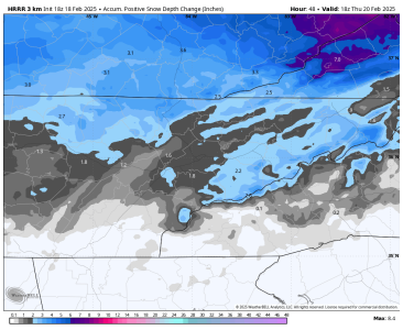
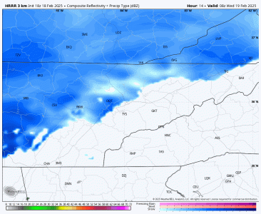
I think the HRRR is latching onto things pretty well. 1-2" for most. A couple of limitations: not much moisture with the system, and late February incoming solar radiation will limit accumulation during the daytime hours.

We'll likely get some light totals of 0.5 to 1.5 inch around sunrise on Wednesday, minor accumulation during the day, and additional light accumulation Wednesday evening east of I-75 as a band of snow sets up near the foothills of the mountains. This band will be aided by strengthening low-level frontogenesis along the western foothills as cold air advection is slowed southward by the terrain, and also by orographic upslope enhancement.

1739915950135.png
1739916117393.gif
 
  • Like
Reactions: hUTch2002
I'll give TDOT some props here in Shelby County. They got (rightfully) blasted last year for failing to treat their roads here, especially by some of the suburban mayors. Much better job this year with both winter events....
 
Thankfully, it's been a huge nothing burger so far. The YouTubers overhyped this "generational storm system" like crazy....

Too much picking the most aggressive model, wishcasting, ignoring the valid limiting factors, and generating clicks than actual analysis......
 
  • Like
Reactions: vols 30
Thankfully, it's been a huge nothing burger so far. The YouTubers overhyped this "generational storm system" like crazy....

Too much picking the most aggressive model, wishcasting, ignoring the valid limiting factors, and generating clicks than actual analysis......
Only fools pay those clowns
 
Need to keep an eye on Saturday and Saturday night for severe weather in East TN. A strong wind field will be present, but the question mark is how much instability will there be.
 

VN Store


Back
Top