WilliamDuVol, that topic is a most worthy thread unto itself. In order to prioritize how best to respond to your request, lets establish a few parameters. Precisely how many days do you have available for hiking in Glacier? How would you describe your current fitness level? Are you interested in day hikes only or would you be potentially interested in an overnight pack trip? Finally, how averse are you to the possibility of bear encounters, particularly those with grizzlies?
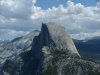
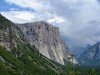
As a rule of thumb, the west side of the park is more heavily forested than the east side, and the northern half of the park is more rugged than the southern half. Taking those two factors into consideration, the Many Glacier valley, located in the northeastern sector, certainly should be a region of emphasis. If you are going to Waterton Lake, you will be taking the Chief Mountain Road. It is too bad that you wont be there in September. The Aspen groves at the base of Chief Mountain then become absolutely ablaze with color, as do the shores of Lower St. Mary Lake, as well as Many Glacier and Two Medicine valleys. In any event, Chief Mountain is most impressive in any season, given the fact that it stands like a lone sentinel, apart from the main range.
Many Glacier offers a host of great day hikes, but it is also prime grizzly habitat. One of the most popular in that region is the Iceberg Lake trail (9.7 miles roundtrip; see
http://www.hikinginglacier.com/iceberg-lake.htm). From the Logan Pass visitor center, you could take the Hidden Lake trail; it is an easy 2.7-mile roundtrip hike to the overlook, but becomes a more strenuous 8.05-mile roundtrip, with more significant elevation gain, if you go all the way to the lake and back (see
http://www.hikinginglacier.com/hidden-lake-overlook.htm and
http://www.hikinginglacier.com/hidden-lake.htm). If you are up to an all-day challenge, try the Highline Trail, sometimes referenced as the Garden Wall Trail (
http://www.hikinginglacier.com/highline-trail.htm). It goes from Logan Pass to the Granite Park chalet (7.6 miles one-way), is quite strenuous, and is above timberline virtually the whole way.
That is enough for an introduction. As noted above, I will post more in several followup segments.