East Tennessee Weather II

Correct, most of the activity within it is moving NE, but the actual forcing there should result in some light continued snow through 9-10pm in East TN (generally near I-40 and north). Not a lot, but enough to make it slick out with temps finally dropping below freezing and into the 20s.

Definitely a disappointment for most of the valley that wanted snow, but when the upper trough stays so far north, it's always hard to get valley snow in these setups.
Well there’s no question your knowledge is far beyond mine when it comes to weather. You’re a 9.5 and I’m a 2 so I’ll trust your judgement. So the low tracked perfectly, we just didn’t get the upper trough quite far enough. It was close to a big snow event but not quite there. Middle TN got pounded. Lucky bastards!
 
I’ll always listen to criticism if it offers a way to improve.

I’m not being a smart ass…but how would you want them to improve?

Not blow a forecast by inches to start. I have no suggestions as it's not my profession. Just like people criticize mine as a nurse with no answers
 
Rain has turned to snow in Kingsport..... With how wet it is and how cold its supposed to get the roads are going to be nasty in the morning.
 
Starting to snow pretty good in Oak Ridge. Up to quarter size flakes.
I was about to ask about this band setting up around the central valley. If there's good dendrite growth (based on your report, the answer sound like yes), could get a quick half inch with it.
KMRX - Super-Res Reflectivity Tilt 1, 6_14 PM.gif
 
I was about to ask about this band setting up around the central valley. If there's good dendrite growth (based on your report, the answer sound like yes), could get a quick half inch with it.
View attachment 426471
It gave us a nice coating in HV. Probably not a half inch but not far from it either. Do you see any other bands coming through this evening?
 
It gave us a nice coating in HV. Probably not a half inch but not far from it either. Do you see any other bands coming through this evening?
Not really I don't think. Maybe some flurries and light additional dusting but pretty much done behind this band. Temperatures dropping quickly though, so even a little accumulation with wet roads could result in some icy travel overnight.
 
Not really I don't think. Maybe some flurries and light additional dusting but pretty much done behind this band. Temperatures dropping quickly though, so even a little accumulation with wet roads could result in some icy travel overnight.
It looks like some is between us and Nashville right now and it stayed farther South than I thought it would. That could potentially hit us.
 
It looks like some is between us and Nashville right now and it stayed farther South than I thought it would. That could potentially hit us.
Could definitely add a little bit. Not expecting much more, probably just an extra dusting to a quart inch around Knoxville.
 
  • Like
Reactions: hUTch2002
Do you remember where? I run the entire neighborhood and I get I’ve seen it. I love it here
great neighborhood to run in -- never realized how large it was until my West HS days in late 60s when i was dating a holston high girl and also used the tennis courts with classmate whose parents were serious golfers. also went to several HHS bball games to watch jimmy england,

When i was younger biggest memory wasu long it took dad us to drive
from west knoxville to visit my grandmother,

Been away from knoxville since 1972. i took up running years later and always loved finding a new route to run in sequoya
h while visiting .my parents
 
Was traveling into work tonight and there was a lot of icy spots developing. Would say it's worse on any untreated roads this morning as temperatures drop into the teens and low 20s. Definitely use caution if you have to travel out Friday morning.

NWS Morristown has a Special Weather Statement issued for black ice this morning.
 
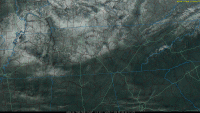
COD-GOES-East-local-Tennessee.truecolor.20220107.204117-over=counties-usint-map-bars=.gif
Neat view of the most recent snow from the GOES-East satellite across Tennessee. You can spot the boundary and nearby track of the surface low where the delineation of rain/snow really setup across the state.

The more I look at this, I don't think downsloping was a major contributor overall. It likely contributed some across the immediate foothills and northeast Tennessee, but it wasn't primarily responsible for the lower totals near Knoxville. Ultimately, the cold front from the day before didn't make it far enough south and the surface low tracked along that boundary on a more northward track. This resulted in temperatures that were a couple degrees warmer than expected into the Knoxville/central valley area and limited overall snowfall.
 
  • Like
Reactions: davethevol


Pretty interesting from James Spann.

I wasn’t born yet. What was the coldest you remember January 1985 being and where?
 

VN Store


Back
Top