East Tennessee Weather II

Good dusting right now in Morristown. However, it looks like it’s changing to rain.

Update 7:21am - within about two minutes, it went from heavy, wet snow, freezing rain, to rain.
 
Last edited:
The NWS is having an absolutely horrible winter with their predictions/guesses.

At this point they could throw a dart blind folded and do better. 6 hour difference and they change this much.


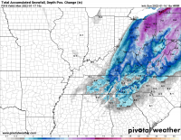
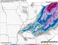
View attachment 428615View attachment 428616

Those are two different time periods. The top image is for 7am Monday through 1 AM Tuesday. Most accumulation that does occur will occur today through early tonight. It looks like one of the automated images they produce for certain time periods on their website.
 
  • Like
Reactions: Matt2496
Good dusting right now in Morristown. However, it looks like it’s changing to rain.

Update 7:21am - within about two minutes, it went from heavy, wet snow, freezing rain, to rain.
All rain in West Knox. No sign of that changing anytime soon.
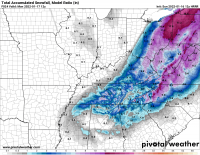
That warm layer in these type of events gets us every time. It's going to be a messy mix of rain, sleet, and snow across much of the valley with temps remaining pretty cold. Been 33°F and mostly rain at my place.

This does a good job of showing the potential accumulation mainly across higher terrain. Can really show the difference in what will fall vs what will accumulate well.

1642339934983.png

What will fall but not necessarily accumulate well:
1642339976250.png
 
Pouring snow in West Knoxville.
Good report! Still rain and 35°F in Strawberry Plains, but it'll start to changeover across the area as low-level flow turns to the N/NE (lose the downslope across the mountains) and the upper low moves across the area with some dynamic cooling.

Not really significant accumulation, but could see up to about an inch in parts of the valley (more recent model below doesn't show accumulation that happened earlier today...this is everything after 11am ET).
1642356114901.png
 
Models are only a guidance. That's why scientists use the word "guidance." A winter storm is not a thunderstorm. It's a combination of many different atmospheric factors, and you don't get the storm until they all come together. We've only been collecting atmospheric data for 150 years. That's not enough to make models facts. Take your models into consideration and turn on the radar. Look at what the low is actually doing. With experience it's much more predictive. There is a reason the experts shut their mouths with events like this. They let amateurs do the talking until the storm is fully realized. The south is just not very experienced with storms like this. It's very tricky business. The south is much better with predicting tropical systems.
 
Good report! Still rain and 35°F in Strawberry Plains, but it'll start to changeover across the area as low-level flow turns to the N/NE (lose the downslope across the mountains) and the upper low moves across the area with some dynamic cooling.

Not really significant accumulation, but could see up to about an inch in parts of the valley (more recent model below doesn't show accumulation that happened earlier today...this is everything after 11am ET).
View attachment 428667
If it doesn’t change back to rain I could see 2+ inches. My car said it’s 33 as I was driving. That’s colder than predicted so hopefully a good sign.
 
  • Like
Reactions: MetVol
If it doesn’t change back to rain I could see 2+ inches. My car said it’s 33 as I was driving. That’s colder than predicted so hopefully a good sign.
I agree. Especially near and west of the I-75 corridor where the best moisture is hanging around with the cold air for some moderate to heavy snow rates for a few more hours.
 
Looks like we now have northeast flow here in norther Anderson County. Can look up in the sky and see the large snowflakes streaming in from the north east about 1000 feet up. Light winds now from the north at about 2 mph. Mostly all snow now at about 33 degrees. Very need to be able to actually see the physics in motion above my head.
 
Latest HRRR is showing 2-4 inches for the valley.
I'd clarify to say it's (18z) showing only 1" or so really sticking (maybe up to 2" in some areas). We'll see how it plays out. Still enough for some tricky road conditions tonight as temperatures drop below freezing.
 

VN Store


Back
Top