
You are using an out of date browser. It may not display this or other websites correctly.
You should upgrade or use an alternative browser.
You should upgrade or use an alternative browser.
East Tennessee Weather II
- Thread starter rocktopper16
- Start date
rocktopper16
Spread sunshine, Not shade.
- Joined
- Jan 8, 2012
- Messages
- 11,705
- Likes
- 10,421

TechnoVol
010101100100011001001100
- Joined
- Jul 27, 2011
- Messages
- 6,706
- Likes
- 11,799
rocktopper16
Spread sunshine, Not shade.
- Joined
- Jan 8, 2012
- Messages
- 11,705
- Likes
- 10,421
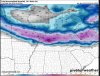
Thanks. Yeah, rain has been keeping me in a holding pattern for 3 weeks. Based on the GFS, I'll be waiting a few weeks more.
Id guess about April 20th you should be good to go. I wish we had this pattern during winter.
But, Climotologist say we have a 5X more chance of seeing tornadoes during the peak of April.
rocktopper16
Spread sunshine, Not shade.
- Joined
- Jan 8, 2012
- Messages
- 11,705
- Likes
- 10,421
volsarelife1
Well-Known Member
- Joined
- Jul 15, 2017
- Messages
- 13,678
- Likes
- 17,410
Vol knight
Text a Buddy!
- Joined
- Oct 2, 2013
- Messages
- 8,959
- Likes
- 3,141
~Severe Weather Bulletin~
There is a Marginal risk for Strong to Severe thunderstorms for most of East Tennessee (except far northeastern areas) tomorrow.
Primary risks:
Damaging winds up to 60mph is the greatest risk.
Isolated large hail up to quarter size is possible.
Timing:
Late afternoon into the early evening hours.
Storm mode:
Linear.
kayakonthefly
Well-Known Member
- Joined
- Oct 3, 2015
- Messages
- 1,816
- Likes
- 1,649
~Severe Weather Bulletin~
There is a Marginal risk for Strong to Severe thunderstorms for most of East Tennessee (except far northeastern areas) tomorrow.
Primary risks:
Damaging winds up to 60mph is the greatest risk.
Isolated large hail up to quarter size is possible.
Timing:
Late afternoon into the early evening hours.
Storm mode:
Linear.
Storm mode linear - does that imply straight line winds? Or does it mean something completely different?
Vol knight
Text a Buddy!
- Joined
- Oct 2, 2013
- Messages
- 8,959
- Likes
- 3,141
rocktopper16
Spread sunshine, Not shade.
- Joined
- Jan 8, 2012
- Messages
- 11,705
- Likes
- 10,421
Vol knight
Text a Buddy!
- Joined
- Oct 2, 2013
- Messages
- 8,959
- Likes
- 3,141
MODERATE risk for a huge swath of the Ohio and Tennessee valley. Includes all of West TN and parts of Middle TN up into Nashville.
Was getting ready to post that. The primary threats with these storms in Middle and West TN will be destructive winds in excess of 70 mph, large hail up to golfball size (especially Northwestern portions of West TN), and a few tornadoes are possible.
Vol knight
Text a Buddy!
- Joined
- Oct 2, 2013
- Messages
- 8,959
- Likes
- 3,141
Vol knight
Text a Buddy!
- Joined
- Oct 2, 2013
- Messages
- 8,959
- Likes
- 3,141
95 Vol Alum
Go Big Vols!
- Joined
- Jan 16, 2010
- Messages
- 63,088
- Likes
- 28,687
Matt2496
Well-Known Member
- Joined
- Dec 2, 2016
- Messages
- 14,083
- Likes
- 22,323
Severe Thunderstorm Watch has now been issued for East Tennessee.
Storm Prediction Center Severe Thunderstorm Watch 34
Storm Prediction Center Severe Thunderstorm Watch 34
Vol knight
Text a Buddy!
- Joined
- Oct 2, 2013
- Messages
- 8,959
- Likes
- 3,141
Severe Thunderstorm Watch has now been issued for East Tennessee.
Storm Prediction Center Severe Thunderstorm Watch 34
Thanks, Matt. I'm just now getting off work. I'm keeping my eye on the storms.
Vol knight
Text a Buddy!
- Joined
- Oct 2, 2013
- Messages
- 8,959
- Likes
- 3,141
Alert!!!!!
The National Weather Service in Morristown has issued a
* Severe Thunderstorm Warning for...
Rhea County in east Tennessee...
Meigs County in east Tennessee...
Sequatchie County in east Tennessee...
Bledsoe County in east Tennessee...
Marion County in east Tennessee...
Hamilton County in east Tennessee...
* Until 115 AM EDT/1215 AM CDT/
* At 1208 AM EDT/1108 PM CDT/, severe thunderstorms were located
along a line extending from near Crossville to 6 miles north of
Sewanee, moving east at 70 mph.
HAZARD...60 mph wind gusts and quarter size hail.
SOURCE...Radar indicated.
IMPACT...Hail damage to vehicles is expected. Expect wind damage
to roofs, siding, and trees.
* Locations impacted include...
Chattanooga, Dayton, Dunlap, Jasper, Pikeville, Decatur,
Soddy-Daisy, Signal Mountain, South Pittsburg, Spring City, Walden,
Lakesite, Whitwell, Kimball, Monteagle, Ridgeside, Harrison,
Fairmount, Red Bank and Collegedale.
Vol knight
Text a Buddy!
- Joined
- Oct 2, 2013
- Messages
- 8,959
- Likes
- 3,141
Vol knight
Text a Buddy!
- Joined
- Oct 2, 2013
- Messages
- 8,959
- Likes
- 3,141
Alert!!!!!
The National Weather Service in Morristown has issued a
* Severe Thunderstorm Warning for...
Morgan County in east Tennessee...
Southern Scott County in east Tennessee...
* Until 100 AM EDT
* At 1216 AM EDT, severe thunderstorms were located along a line
extending from 11 miles northeast of Fairfield Glade to 10 miles
southwest of Crossville, moving east at 45 mph.
HAZARD...60 mph wind gusts.
SOURCE...Radar indicated.
IMPACT...Expect damage to roofs, siding, and trees.
* Locations impacted include...
Wartburg, Oliver Springs, Huntsville, Harriman, Sunbright, Oakdale,
Rugby, High Point, Coalfield, Smokey Junction, Pine Orchard,
Robbins, Rugby State Park, Deerlodge, Norma, Elgin, Frozen Head
State Park, Slick Rock and Petros.
Vol knight
Text a Buddy!
- Joined
- Oct 2, 2013
- Messages
- 8,959
- Likes
- 3,141
Alert!!!!!
The National Weather Service in Morristown has issued a
* Severe Thunderstorm Warning for...
Western Claiborne County in east Tennessee...
Anderson County in east Tennessee...
Campbell County in east Tennessee...
Union County in east Tennessee...
Eastern Scott County in east Tennessee...
* Until 130 AM EDT
* At 1223 AM EDT, severe thunderstorms were located along a line
extending from near Hollyhill to 11 miles south of Huntsville,
moving east at 60 mph.
HAZARD...60 mph wind gusts.
SOURCE...Radar indicated.
IMPACT...Expect damage to roofs, siding, and trees.
* Locations impacted include...
Clinton, La Follette, Maynardville, Oliver Springs, Jacksboro,
Harrogate, Jellico, Caryville, Lake City, Norris, Luttrell, Norris
Dam State Park, Elk Valley, Cumberland Gap, Arthur, Smokey
Junction, Rosedale, Rose Hill, Big Ridge State Park and Cove Lake
State Park.
Vol knight
Text a Buddy!
- Joined
- Oct 2, 2013
- Messages
- 8,959
- Likes
- 3,141
An update on one of the warnings!!!
...A SEVERE THUNDERSTORM WARNING REMAINS IN EFFECT UNTIL 130 AM EDT
FOR WESTERN CLAIBORNE...ANDERSON...CAMPBELL...UNION AND EASTERN SCOTT
COUNTIES...
At 1248 AM EDT, severe thunderstorms were located along a line
extending from near Lot to 9 miles south of Jacksboro, moving east at
60 mph.
HAZARD...60 mph wind gusts.
SOURCE...Radar indicated.
IMPACT...Expect damage to roofs, siding, and trees.
Locations impacted include...
Clinton, La Follette, Maynardville, Oliver Springs, Jacksboro,
Harrogate, Jellico, Caryville, Lake City, Norris, Luttrell, Norris
Dam State Park, Elk Valley, Cumberland Gap, Arthur, Smokey Junction,
Rosedale, Rose Hill, Big Ridge State Park and Cove Lake State Park.
PRECAUTIONARY/PREPAREDNESS ACTIONS...
This is a DANGEROUS SITUATION. These storms have a history of
producing widespread wind damage across Fentress and Cumberland SEEK SHELTER NOW inside a sturdy structure and stay away
from windows.
Vol knight
Text a Buddy!
- Joined
- Oct 2, 2013
- Messages
- 8,959
- Likes
- 3,141
Alert!!!!!
The National Weather Service in Morristown has issued a
* Severe Thunderstorm Warning for...
Loudon County in east Tennessee...
Southern Anderson County in east Tennessee...
Western Knox County in east Tennessee...
Roane County in east Tennessee...
* Until 145 AM EDT
* At 1259 AM EDT, severe thunderstorms were located along a line
extending from near Midtown to 7 miles southwest of Fairview,
moving east at 50 mph.
HAZARD...60 mph wind gusts.
SOURCE...Radar indicated.
IMPACT...Expect damage to roofs, siding, and trees.
* Locations impacted include...
Knoxville, Oak Ridge, Clinton, Lenoir City, Kingston, Rockwood,
Loudon, Farragut, Fairview, Oliver Springs, Louisville, Midtown,
Harriman, Friendsville, Paint Rock, Bradbury, Dearmond, Karns,
Tellico Village and Coalfield.
Vol knight
Text a Buddy!
- Joined
- Oct 2, 2013
- Messages
- 8,959
- Likes
- 3,141
VN Store
