Severe Weather Thread

ATTENTION, Gulf Coast & Far East coast vols.


96L isn't being monitored as is should be. I will post some model runs tonight. It has strong potential to be a Cat 3-4. Thanks guys!
 
Just got an NWS alert for crazy weather supposedly coming Monday night into Tuesday.

==================

Issued by The National Weather Service
Knoxville/Tri-Cities, TN
Updated Oct 12, 2014, 5:10pm EDT

National and Local Weather News
Watches & Warnings Explained
Storm Watch (video)
... SEVERE THUNDERSTORMS... TORRENTIAL RAINS AND FLASH FLOODING ARE POSSIBLE TUESDAY... ... HIGH WIND WATCH IS IN EFFECT FOR THE MOUNTAINS AND ADJACENT FOOTHILLS FOR MONDAY NIGHT AND TUESDAY...
A STRONG STORM SYSTEM AND ASSOCIATED COLD FRONT WILL MOVE ACROSS THE TENNESSEE VALLEY AND SOUTHERN APPALACHIANS FROM LATE MONDAY NIGHT THROUGH TUESDAY. THIS SYSTEM WILL TIGHTEN THE PRESSURE GRADIENT ACROSS THE REGION PRODUCING STRONG AND GUSTY WINDS OVERTHE MOUNTAINS AND ADJACENT FOOTHILLS MONDAY NIGHT AND TUESDAY. THE HIGH WINDS MAY DOWN TREES AND POWER LINES.
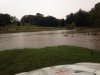
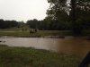
THIS SYSTEM WILL PULL ANOTHER ROUND OF HEAVY RAINFALL BACK INTO THE AREA TUESDAY. SINCE THE GROUND IS ALREADY SATURATED FROM THE RECENT RAINFALL... THE ADDITIONAL HEAVY RAINS MAY PRODUCE FLASH FLOODING OF STREAMS... STREET FLOODING... FLOODING OF LOW-LYING AREAS AND MUD SLIDES.
AS THE COLD FRONT MOVES THROUGH TUESDAY... WIDESPREAD THUNDERSTORMS ARE EXPECTED. DUE TO THE STRONG WINDS ALOFT... SOME OF THESE STORMS MAY PRODUCE DAMAGING WINDS WITH AN ISOLATED TORNADO. THE EXACT TIMING OF THE STORMS ARE STILL UNCERTAIN.
 
I've got the radar going for the Jackson & W.TN area & Arkansas is getting pounded by heavy rain & thunderstorms coming up from the South which is clashing w/a cold front coming in from the North. Heavy rain & high winds are due for us here in W.TN w/a possible tornado watch this afternoon around 3-4 pm.
 
We just now are starting to get the rain. Not as bad as I thought. Where I am we are in the yellow to red down pour. Looks as if South Jackson is getting heavy rain which is a flash flood. It's now moving NE towards Lexington, TN.
 
Storms!!!

tumblr_n9m0708yYc1qgsjxzo1_400.jpg
 
We just now are starting to get the rain. Not as bad as I thought. Where I am we are in the yellow to red down pour. Looks as if South Jackson is getting heavy rain which is a flash flood. It's now moving NE towards Lexington, TN.

My pastures were flooded this morning. All the creeks on my place were over flowing. Roads were closed and cars were stalled out. Rough morning here.
 

Attachments

  • image.jpg
    image.jpg
    47.3 KB · Views: 7
My pastures were flooded this morning. All the creeks on my place were over flowing. Roads were closed and cars were stalled out. Rough morning here.

Thats crazy. Just now getting here in north bama. I hear the fun is really going to start later tonight.
 
Huntsville is getting hit pretty hard right now. Just shut down it's international airport due to lightning and high winds.
 
Tornado Watch for Southeast Tennessee until 7:00 AM est.

Edit: 2 hours after it's issued, the watch is cancelled, lol.
 
Last edited:
Tornado Watch for all of upstate SC. Tornado Warning in Oconee, Greenville and Pickens counties. The warning is mainly for the mountainous areas. Storms haven't even started yet (near me, in Greenville County). Could be an interesting day.
 
My Dad keeps a Rhino and Kawasaki Mule at his place.

You can't kill those things.

This is my second one. First one was a 2006 450 in camo. This one is a 2011 special edition. 700 fuel injected. I upgraded the tires to 27x12x12 swamp witches. 4500 pound viper winch and I installed a sound bar out of a jeep.

My old one is still alive and kicking as well. Sold it to family.
 
This is my second one. First one was a 2006 450 in camo. This one is a 2011 special edition. 700 fuel injected. I upgraded the tires to 27x12x12 swamp witches. 4500 pound viper winch and I installed a sound bar out of a jeep.

My old one is still alive and kicking as well. Sold it to family.

That sounds cool. :hi: Got a picture of the 2011 to post?
 

VN Store


Back
Top