East Tennessee Weather II

Good evening, guys. I apologize that I haven't been posting anything recently, especially with the upcoming system. I've definitely have had a lot of stuff happen in life in recent months. I appreciate everyone who has been keeping others updated on the weather. I'll try to chime in with my thoughts as much as I can.
 
Good evening, guys. I apologize that I haven't been posting anything recently, especially with the upcoming system. I've definitely have had a lot of stuff happen in life in recent months. I appreciate everyone who has been keeping others updated on the weather. I'll try to chime in with my thoughts as much as I can.
Hope all is good.
 
  • Like
Reactions: KnoxLandcruiser
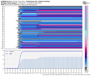
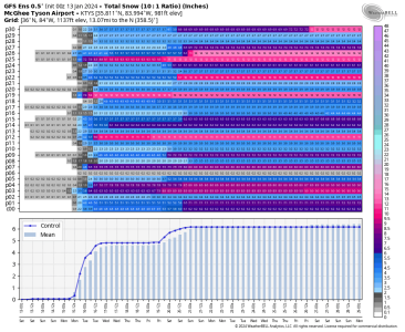
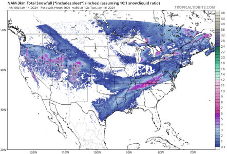
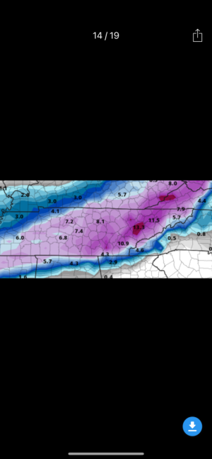
Most of Tennessee is in a Winter Storm Watch for Monday. Looks like at least 2 to 5 inches around the East Tennessee area. Might could get more than that where the more intense band sets up, but that location is still a little more uncertain. Ensembles still on board with a good accumulating snow but whether it's 1-2 inches or 7-8 inches is still the question.

1705138108233.png

1705138119803.png

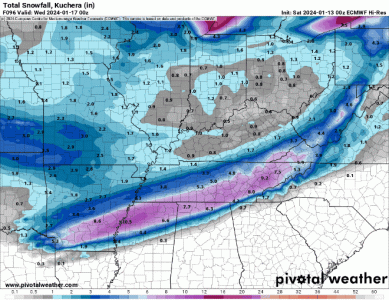
And a compilation of the latest deterministic runs using Kuchera ratio snowfall:
1000001271.gif
 
For Memphis:

Probably 3-4 inches. Higher amounts possible closer to MS/TN state line. Most, but not all, models keep heaviest precip over Northern MS.

Euro had been inching heavier precip up closer to TN/MS line yesterday but in 12Z dropped heaviest precip towards 3rd-4th row of MS counties (think Batesville to Grenada). It is most southerly of the models but if it's accurate, areas north of Shelby County may see a bust (2 or less).


This more southerly track may throw off more snow in Chatt area than previously thought if it holds...
 
  • Like
Reactions: KnoxLandcruiser
Gotten strangely quiet in here. Quiet before the storm? Any updates to what we can expect?
Models are still not in agreement. Some are showing a warm noise trying to creep in and I don’t buy that due to it not be a strong costal storm. Local Mets are riding with the NAM for now. 0Z should be prime time for everyone.
 
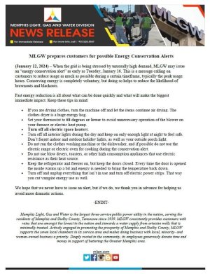
MLGW is an absolute embarrasment and represents perfectly the incompetence of the local govt...

The people in the field are amazing. The thousands of unnecessary admin/political patronage jobs are sucking the customers dry....
 
So if you had to guess right now, what’s West Knoxville end up with on the ground?
WATE’s weather lady just said Knoxville’s snow chances are going up by the moment.

She’s saying at least 3-5 inches for the valley by Tuesday afternoon.
 
Last edited:
Models are still not in agreement. Some are showing a warm noise trying to creep in and I don’t buy that due to it not be a strong costal storm. Local Mets are riding with the NAM for now. 0Z should be prime time for everyone.

I'm really liking what 0z run is showing with the NAM
 
I don’t trust the NAM at this point.

All other models are in a pretty tight agreement. ICON goes boom for the valley with the latest run.
 
  • Like
Reactions: KnoxLandcruiser
Winter Storm Warning now for the entire state.

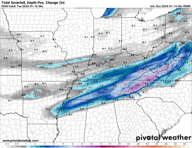
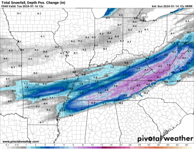
The HRRR is finally incorporating most of the event. It was trying to switch over to a mix because it was drying out the dendritic growth zone, but it appears to be remaining more saturated. This is based on 0.5-0.8 liquid equivalent precipitation across a good chunk of East Tennessee. That band just north of the 850mb frontogenesis axis is going to churn out some good snow amounts on Sunday night into Monday night.

1705227096733.pngWinter Storm Warning
 
Last edited:
Winter Storm Warning now for the entire state.

The HRRR is finally incorporating most of the event. It was trying to switch over to a mix because it was drying out the dendritic growth zone, but it appears to be remaining more saturated. This is based on 0.5-0.8 liquid equivalent precipitation across a good chunk of East Tennessee. That band just north of the 850mb frontogenesis axis is going to churn out some good snow amounts on Sunday night into Monday night.

View attachment 610076Winter Storm Warning

That doesn’t look good for us West TN folks…😢
 
Looks like a sharp cutoff for our Monroe county friends. I wouldn’t buy that as of now.

Met, it looks like it may start sooner than expected are you seeing that trend?
 

VN Store


Back
Top