Severe Weather Thread

Tornado Heading for Yazoo City

Both screenshots are of the same storm
 

Attachments

  • screenshot-3.jpg
    screenshot-3.jpg
    72.8 KB · Views: 0
  • screenshot-2.jpg
    screenshot-2.jpg
    68.3 KB · Views: 0
If those storms around Tupelo hold together then around the Chattanooga area good be interesting especially Chattanooga and south!
 
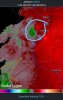
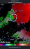
Well folks, I was hoping we might not ever see a day like we did in April 2011, but today might be it

Its going to get real bad in Mississippi and parts of Alabama today and tonight. Conditions are right for a massive outbreak of long track tornadoes.

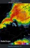
As far as middle tn, you guys may not be all that bad. The rain and clouds from the morning will likely cause a cap in the atmosphere, stopping the development of any violent tornadic storms. Most of the worst will be too your south

These Tornadoes are massive, killer Tornadoes. It's unsettling that these monsters started so early in the day. Storms will march across bama this evening causing massive damage with fatalities, unfortunately. Going to be a long night. 2011 part 2 for sure.
 
Last edited:
Shutting down the base here and not opening up til, at the earliest, noon tomorrow............da ****

Contractor that I work for put us on liberal leave today and tomorrow. Luckily I have stuff to do where I can log in from home so I can still get paid. Would suck if I needed to be in a closed area tomorrow, I wouldn't get paid unless I use leave.
 
Issued by The National Weather Service
Knoxville/Tri-Cities, TN
Mon, Apr 28, 2014, 6:05 PM EDT

... ENHANCED TORNADO POTENTIAL ACROSS THE PLATEAU... ESPECIALLY SOUTHERN PLATEAU... AND SOUTHEAST TENNESSEE BETWEEN 7 AND 10 PM ET (6 AND 9 PM CT)...

AN AREA OF SEVERE THUNDERSTORMS... SOME TORNADIC... WILL MOVE NORTHEAST AT 50 MPH FROM NORTHERN ALABAMA INTO THE PLATEAU COUNTIES AND SOUTHEAST TENNESSEE BETWEEN 7 AND 10 PM ET (6 AND 9 PM CT). THE LATEST MODEL DATA SUGGEST INCREASING SHEAR AND UPPER LEVEL FORCING OVER THIS AREA THIS EVENING WHICH WILL ENHANCE THE POTENTIAL OF STRONG TORNADOES.
BESIDES THE INCREASED POTENTIAL OF TORNADOES... HEAVY RAINFALL CAN ALSO BE EXPECTED WITH THESE STORMS THIS EVENING AND OVERNIGHT. BE ALERT TO POTENTIAL FLASH FLOODING OF LOW LYING AREAS... STREET FLOODING AND STREAM FLOODING.
 
The bad cell around Athens has taken a hard left turn, thankfully. Unless something changes I may get out of this with just a bunch of rain.
 

VN Store


Back
Top