You are using an out of date browser. It may not display this or other websites correctly.
You should upgrade or use an alternative browser.
You should upgrade or use an alternative browser.
East Tennessee Weather II
- Thread starter rocktopper16
- Start date
WallyBalls
Atom Wrangler
- Joined
- Aug 15, 2010
- Messages
- 7,388
- Likes
- 5,137
headhunter15
Well-Known Member
- Joined
- Mar 5, 2010
- Messages
- 9,203
- Likes
- 33,372
headhunter15
Well-Known Member
- Joined
- Mar 5, 2010
- Messages
- 9,203
- Likes
- 33,372
MetVol
🌪️⚡❄️☀️🎣
- Joined
- Dec 8, 2020
- Messages
- 240
- Likes
- 708
If that Low can move westward, we could get some snow.
Met and RT, what you all think?
If it moves westward, we could. I'm just not sold on that yet. That southern diving shortwave is taking a good track, but it just doesn't phase up well until it gets off the coast. It's still early in the week though, so certainty in the exact track of the surface low is poor. The next 24-48 hours will give us some better data for models.
Ensembles are at least showing the potential for some light snow, and it's going to be cold, so at least bears watching.
MetVol
🌪️⚡❄️☀️🎣
- Joined
- Dec 8, 2020
- Messages
- 240
- Likes
- 708
Finally had a chance to really look into this today. Still doesn't look like a meaningful snow accumulation across the valley, but it's setting up nicely for a significant northwest flow snowfall across the mountains. With temperatures dropping so quickly, the shallow moisture and NW winds of 15-25 mph will produce upslope flow and orographic lift across the mountains and foothills with snow expected to continue Friday afternoon through Friday night. Wouldn't be surprised to see totals of 4-8" across portions of the higher elevations. My guess would be that US 441 across the mountains will likely be closing down sometime Friday afternoon through at least Saturday morning.


headhunter15
Well-Known Member
- Joined
- Mar 5, 2010
- Messages
- 9,203
- Likes
- 33,372
MetVol
🌪️⚡❄️☀️🎣
- Joined
- Dec 8, 2020
- Messages
- 240
- Likes
- 708
Good snow event coming for the mountains. Impressive how long the dendrite growth zone stays saturated near the mountains through Friday night for efficient northwest flow snowfall. Some of the heavier snow events each year in the mountains are due to efficient northwest flow snowfall.
May have some flurries and a dusting to a half inch across parts of the valley but main impacts are in the mountains.
Really cold air and wind chills Saturday morning.

May have some flurries and a dusting to a half inch across parts of the valley but main impacts are in the mountains.
Really cold air and wind chills Saturday morning.

headhunter15
Well-Known Member
- Joined
- Mar 5, 2010
- Messages
- 9,203
- Likes
- 33,372
volsarelife1
Well-Known Member
- Joined
- Jul 15, 2017
- Messages
- 14,407
- Likes
- 18,399
headhunter15
Well-Known Member
- Joined
- Mar 5, 2010
- Messages
- 9,203
- Likes
- 33,372
hUTch2002
Wait til next year!
- Joined
- Jul 30, 2018
- Messages
- 20,705
- Likes
- 24,012
Very light dusting in West Knox.West end of Hamblen Co. got what looked like a good inch with roads completely covered. City of Morristown advised this morning against travel if you didn’t have to. The east end didn’t get a single flake.
Crazy.
*NWS said they received about 1.5 inches of snow due to a snow squall.
headhunter15
Well-Known Member
- Joined
- Mar 5, 2010
- Messages
- 9,203
- Likes
- 33,372
headhunter15
Well-Known Member
- Joined
- Mar 5, 2010
- Messages
- 9,203
- Likes
- 33,372
headhunter15
Well-Known Member
- Joined
- Mar 5, 2010
- Messages
- 9,203
- Likes
- 33,372
MetVol
🌪️⚡❄️☀️🎣
- Joined
- Dec 8, 2020
- Messages
- 240
- Likes
- 708
Judging by the 12z GFS, Tennessee could miss out on a big system to our west and one in the Carolina’s and Virginia next week.
Hey, Met. Have you seen the 12z Euro today? Showing the system moving a little further SE. Think it moves into East TN?
At this point, I think it looks like more a heavy rain event for East Tennessee. I guess it can at least wash the salt off the roads.
Both the ECMWF and GFS show ridging increasing across Florida and the coastal SE CONUS. This places us in deep southwest flow with increasing chances for rain. This type of setup usually favors warmer weather across the Southeast with the colder air moving southward across the Great Plains and Mid-Mississippi Valley. There will be a band of snow, and probably a good ice storm, on the cold side of this surface low, but I think it probably doesn't bring cold air this far enough southeast into East Tennessee with the ridging. Parts of West or Middle Tennessee would have better chances of seeing some wintry weather in this pattern. In these setups, shallow Arctic air also has a difficult making it east of the Cumberland Plateau into East Tennessee.
It's still nearly a week out, so it's something to watch. If that ridge around Florida is weaker or shifts a little further east, maybe the colder air can make it into our area. Just think it's more of a heavy rain pattern for East Tennessee as things stand right now.
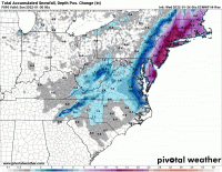
Edit: I sent this and then WPC posted the following image which lines up with my thoughts on what is most probable at this point.

headhunter15
Well-Known Member
- Joined
- Mar 5, 2010
- Messages
- 9,203
- Likes
- 33,372
At this point, I think it looks like more a heavy rain event for East Tennessee. I guess it can at least wash the salt off the roads.
Both the ECMWF and GFS show ridging increasing across Florida and the coastal SE CONUS. This places us in deep southwest flow with increasing chances for rain. This type of setup usually favors warmer weather across the Southeast with the colder air moving southward across the Great Plains and Mid-Mississippi Valley. There will be a band of snow, and probably a good ice storm, on the cold side of this surface low, but I think it probably doesn't bring cold air this far enough southeast into East Tennessee with the ridging. Parts of West or Middle Tennessee would have better chances of seeing some wintry weather in this pattern. In these setups, shallow Arctic air also has a difficult making it east of the Cumberland Plateau into East Tennessee.
It's still nearly a week out, so it's something to watch. If that ridge around Florida is weaker or shifts a little further east, maybe the colder air can make it into our area. Just think it's more of a heavy rain pattern for East Tennessee as things stand right now.
Edit: I sent this and then WPC posted the following image which lines up with my thoughts on what is most probable at this point.

You think winter could potentially be over for East TN? I mean with a favorable pattern like we have had.
MetVol
🌪️⚡❄️☀️🎣
- Joined
- Dec 8, 2020
- Messages
- 240
- Likes
- 708
You think winter could potentially be over for East TN? I mean with a favorable pattern like we have had.
Seasonal forecasting is not my specialty, but I wouldn't be ready to write winter off at this point. Still could have cool, below normal temperatures by next weekend depending on where that front sets up (I'm just thinking it's going to be west of us at this point). I've seen some pretty significant cold outbreaks in mid to late February, and I don't see any really big changes yet that would make me think we're headed straight to spring weather (as much as I'd personally like that haha).
MetVol
🌪️⚡❄️☀️🎣
- Joined
- Dec 8, 2020
- Messages
- 240
- Likes
- 708


