Vol knight
Text a Buddy!
- Joined
- Oct 2, 2013
- Messages
- 8,958
- Likes
- 3,141
I'm sure it will change again..probably start coming together Thursday...72 hours out the models get more accurate
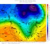
As much as I enjoy posting good model runs, I have to be fair and post a bad one for snow. 0z Euro goes from a Miller A setup to a Miller B setup. What that means is areas in Middle TN could see 2-3 inches before it changes to rain for everyone in TN.
Again, it's a fantasy run. Like previous model runs, I'm taking this one with a grain of salt. JC is right in that we won't start to have a good idea of what's going to happen until we get into the 72 hour timeframe.