East Tennessee Weather

Status
Not open for further replies.
It would be great to see some snow but I'm skeptical for any measureable snow...temps this week are in the 60s so I think the ground will be too warm

showmap.jsp

Depends how fast it falls.

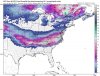
Looking at the latest GFS it has shifted South and East. The cold will be in place just depends on the track coming back North. Still 5 days out and I like being on the North side. Need it to glide over Atlanta and up the Carolinas.
 
Last edited:
Yikes, the 0z GFS now looks just like the 12z Euro. This may be one of those rare instances where the system doesn't trend northwest. If this is still showing on Wednesday, then I'd start lowering expectations for this weekend.
 
Yikes, the 0z GFS now looks just like the 12z Euro. This may be one of those rare instances where the system doesn't trend northwest. If this is still showing on Wednesday, then I'd start lowering expectations for this weekend.

Yeah that's a huge shift
gfs_asnow_us_23.png
 
Yeah that's a huge shift
gfs_asnow_us_23.png

I've not given up on the system yet. It still seems weird that the deep south is seeing snow. With 5 days until this system hits the Southeast and the system not making landfall in the United States until Wednesday, there's still a good chance that this shifts north.
 
I've not given up on the system yet. It still seems weird that the deep south is seeing snow. With 5 days until this system hits the Southeast and the system not making landfall in the United States until Wednesday, there's still a good chance that this shifts north.

Agreed. Not saying it won't keep its current track but watching the Low move from East Tx straight across to the Florida panhandle is very suspect.
 
18z GFS Para (This is the newer version of the GFS):
 

Attachments

  • gfsp_asnow_eus_23.jpg
    gfsp_asnow_eus_23.jpg
    93.4 KB · Views: 13
Last edited:
0z Euro has also shifted north. It's showing the Plateau and areas east 3-6 inches.

GFS holding same pattern this morning. NAM veering a little different path and like you said Vol Knight Euro bringing it back North.


Until it gets onshore not trusting any models at this point.

Watching the local news when you see ???? marks in their forecast you know the models are throwing them curveballs as well. Lol
 
So, all the models sans the GFS are trending snow for the plateau/east?

They are showing the LP move back to the North with each run.

The GFS and GFS para have it crossing central Florida before heading North.

The only thing being agreed on is very cold air in the deep south.
 
Last edited:
What is the website to show the model runs again? thanks

For free websites, tropical tidbits and pivotal weather are really good. If you want access to the Euro and its ensembles, then weatherbell is a good site for that. Weatherbell does cost over $20 a month.
 
GFS is now on an island in the opposite direction. Every other model has backed off the Gulf low track.

CMC still shows a low track. It's interesting. I don't see the high being a factor like the GFS is suggesting. It's just the track record with the GFS last winter.
 
They are showing the LP move back to the North with each run.

The GFS and GFS para have it crossing central Florida before heading North.

The only thing being agreed on is very cold air in the deep south.


Last year we battled the cold air with systems now we are starting it without the battle. The ground will be cold enough. If we see a shift of just a 100 miles north we could see a decent snow.
 
12z Euro was in a good spot. 3-5 inches in the valley. The system comes on shore tomorrow morning, which means we should get a better handle of the track of the system tomorrow evening.
 
Status
Not open for further replies.

VN Store


Back
Top