East Tennessee Weather

Status
Not open for further replies.
Anybody have any updates on what's expected for the Knoxville area?

I'm no meteorologist, but from the satellite tracking it looks like the worst of the line is going to be north and won't hit Knoxville directly.
 
According the radar we are getting hit hard right now. But outside it's a hard rain at most. This may be a dud, which I'm very ok with.


I'm sorry, guys. After the first round passed through, I fell asleep, lol. There's a flash flood warning for Knox County for a couple more hours. If you don't have to be on the roads, I'd wait till the storms have ended.
 
Whew..this one had me worried thankfully, other than some flash flooding, it looks like ET came out fairly well
 
Whew..this one had me worried thankfully, other than some flash flooding, it looks like ET came out fairly well

There were a decent amount of wind damage reports today in East Tennessee. The blue dots on the map below show wind damage.
 

Attachments

  • Screenshot_20170301-225308.jpg
    Screenshot_20170301-225308.jpg
    54.9 KB · Views: 3
Pretty much. We've had a full day of the models being very similar to each other.

Well, the similarities have ended. Here's 3 models (GFS, Euro, and NAM) that have wide differences in amounts at this time. The GFS is the one at the top, the Euro is the bottom left one, and the NAM is the bottom right one.
 

Attachments

  • Screenshot_20170309-150800.jpg
    Screenshot_20170309-150800.jpg
    115.2 KB · Views: 17
Here's the latest from Morristown:

17191291_10154714385542655_1742357619306423339_n.png.jpg
 
Alert!

..Widespread Snowfall expected Saturday night into Sunday Morning
with much colder air anticipated over the weekend into next
week...

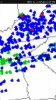
Winter will return this weekend as a system brings widespread
snowfall to the area Saturday night into Sunday morning. Snow
accumulations along and north of I-40 will be in the 2-5 inch
range with locally higher amounts above 3500 feet. Elsewhere,
expect accumulations of 1-3 inches will be possible. The snow will
be heavy enough to cause scattered to numerous travel issues
across the region late Saturday into early Sunday. Temperatures
should warm enough on Sunday to alleviate most travel issues by
Sunday afternoon. In addition, much colder temperatures are
expected next week with morning lows in the 20s most morning with
teens possible in NE TN and SW VA.

Please stay tuned for further updates over the next couple of
days.
 
Status
Not open for further replies.

VN Store


Back
Top