East Tennessee Weather

Status
Not open for further replies.
~Severe Weather Bulletin~

There's a marginal risk for some strong thunderstorms to an isolated severe thunderstorm for areas south and west of Knox County overnight.

Main threat with the stronger storms will be gusty to damaging winds 40-60 mph. There could also be localized small stream and creek flooding.
 
I thought more of the regular posters would be excited about the potential snowfall. Very quiet in this thread.
 
My reaction when I saw the 0z NAM run:

HorrifiedFace.gif
 

Attachments

  • IMG_0787.JPG.60c23512b5d30ae20fa2cf4c82518306.jpg
    IMG_0787.JPG.60c23512b5d30ae20fa2cf4c82518306.jpg
    86.4 KB · Views: 7
Getting me excited over here, VK!

It would be epic if that came to pass. Unfortunately, I think this is the classic case of the NAM being too amped up. Most of the models (including the high resolution NAM) are showing 2-4 inches for the central and northern valley, and 1-3 inches for the southern valley. The system will move into the US tonight, so we'll have a clear picture of what to expect tomorrow.
 
It got pretty scary here
 

Attachments

  • 20170309_223120.jpg
    20170309_223120.jpg
    20.9 KB · Views: 2
  • 20170309_223753.jpg
    20170309_223753.jpg
    25.5 KB · Views: 2
Wow, the 0z Euro did a 180 from the last few runs. Before this run, it was trending drier and colder. Other models today were starting to slightly move towards the Euro. Now, the Euro is starting to move towards the NAM, showing 3-6 inches in the valley. With the system now making landfall in the Northwest, the models will be able to sample the system better.
 
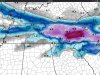
Are the totals showing total accumulation, or precipitation? It's going to take awhile before it will actually stick

The ground is warm. NWS Morristown discussed this in their discussion. Basically said the snow would be falling so hard and quick it would trump a warm ground. Then you factor in it falling at night which would also trump a warm ground.

I think any totals given to this point are opinions. Once the 12z models come out it should give us a better idea.
 
Not looking so good with the latest runs.

The last couple runs show the system getting sheared out on the GFS and NAM. It's not time to throw in the towel yet, as the models are still trying to get a good handle on this system. The 12z Euro will be interesting to see if it maintains the high amounts from last night or trends towards the GFS/NAM. If you put a gun to my head and told me that I had to choose one model to trust over the others, I would pick the Euro.
 
Last edited:
12z Euro shifted south slightly. It's showing 2-5 inches from Knoxville and areas south. Very little north of Knoxville on that run.
 
Weather Models :: Twister

Since I was curious about the models, but didn't want to ask.

Also, do any of you subscribe to Stormpulse? That was a great free site at one time, but they switched to a fairly high-dollar subscription service a few years ago.
 
Status
Not open for further replies.

VN Store


Back
Top